
Geographic Information Systems (GIS) have greatly impacted the agricultural field and has helped farmers and researchers in data gathering, processing, and management. Open source GIS software is now available to the public and can be easily modified to suit the needs of the agricultural societies. In this article, the authors will describe how the application of open source GIS is contributing to the improvement of productivity and efficiency of agricultural activities.
Precision Farming with Open Source GIS
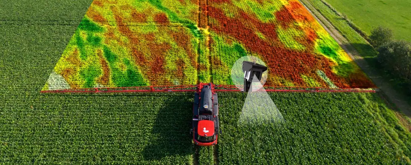
Open source GIS software like QGIS and GRASS GIS is used in precision farming where it helps in preparing maps of soil type, crop status, and weather conditions. Due to the availability of data from satellites, sensors, and field surveys, open source GIS helps farmers to plan the use of resources and identify areas that need attention. This precise method minimizes the usage of resources, minimizes the effects on the environment and increases the efficiency of the process.
Collaborative Data Collection and Sharing
This is because open source GIS helps farmers, researchers, and other agricultural institutions to collect and share information. Such platforms as OpenStreetMap allow the community members to share their experience and observations and create a detailed map of the available agricultural resources and recommendations. Thus, the sharing of data and knowledge enables the involved parties to tackle problems and create new strategies for the advancement of sustainable farming.
Monitoring and Forecasting Crop Health
Open source GIS applications are useful in tracking the health status of crops and the likelihood of occurrences such as pest and diseases as well as adverse weather conditions. As a result of this, GIS models can use historical data and current data to come up with patterns and trends that can be used in decision making. This way, farmers are able to prevent the occurrence of the problems and thus minimize the losses and guarantee the sustainability of the crops.
Optimizing Resource Management
The proper utilization of resources is very vital in agriculture especially in the current world. Open source GIS is used by farmers to manage water and fertilizers and pesticides by offering information on the soil, water, and nutrients. Through this, farmers can optimize on the use of the resources in order to reduce on wastage, environmental impacts and enhance resource productivity.
Empowering Local Communities

Local agricultural communities are benefited by open source GIS because it gives them the tools and information they need for better farming. This is because open source GIS initiatives incorporate community members in the data collection and mapping processes hence they are more likely to own and protect the data. Also, the open source GIS platforms provide farmers with learning materials and training to help them learn new technologies and methods.
Adapting to Climate Change
Climate change affects agriculture in many ways, for instance, changes in weather patterns, occurrence of disasters, and invasion of new diseases and pests. This is where open source GIS comes in; it assists farmers and researchers to comprehend climate change and its effects and come up with strategies to cope with it through modeling of climate change effects, crop improvement, and sustainable farming. Thus, the use of open source GIS can help the agricultural sector to be more flexible and adapt to the conditions of climate change.
Conclusion
Thus, open source GIS is a powerful and efficient tool to improve the efficiency and effectiveness of agriculture. Thus, open source GIS offers tools for precision farming, collaborative data collection, crop health monitoring, resource management optimization, community capacity building, and climate change mitigation and adaptation in the agricultural sector. Therefore, as the need for sustainable food production increases in the future, the application of open source GIS in agriculture will play an even more important role.